
Alaska Department of Transportation and Public Facilities
TransportationX

Project Number: Z566310000/0A31034
About the Project
1. Why
Ask virtually any Southcentral Alaska resident, and they’ll tell you about the time they were stuck in traffic on the Seward Highway for hours because of a car crash up ahead and how they had to watch emergency vehicles squeeze past miles of backed up cars, trucks, and motor homes trying to reach injured motorists.


Or maybe they’ll tell you how they had to dodge falling rocks or ice.
Or maybe how they had to slam on the brakes because a driver decided to pull off the road at the last minute to look for sheep – or beluga whales.
The only way for bikes or pedestrians to get around is within tight shoulders. Sometimes people dash across the highway on foot to try and see animals or sunsets.
In just the past 5 years (2018-2022), there have been 9 fatal crashes on the Seward Highway Safety Corridor and another 21 crashes in which people suffered serious injuries (Safety Corridor Audit 2022, pg. 15). Crash rates have gone down since the area was designated a state Safety Corridor, but serious crashes have not.


The data shows that since the highway became a safety corridor in 2006, crashes have decreased but fatalities have not. And if you look even closer, the increased frequency of crashes doesn’t appear to occur when more people are on the road in summer; it actually happens in December and February when the weather conditions impact the appropriate safe speed for vehicles. To date, the Alaska Department of Transportation and Public Facilities (DOT&PF) has spent over $100M in safety improvements throughout the corridor, but the improvements have not stopped the worst crashes. This problem requires a more comprehensive project to improve safety over the long term.
Also, there are a lot of people who illegally cross the railroad tracks to access cool places along the water, which carries severe safety consequences. In a recent study at Beluga Point, the railroad documented almost 1,000 trespassing pedestrian crossings in a day. In 2022, one person died walking along the railroad tracks near Bird Point.
We need to make the Seward Highway corridor safer for everyone.
2. What’s being done?
The Alaska Department of Transportation and Public Facilities (DOT&PF) wants to make long-term highway improvements on the Seward Highway between Rabbit Creek Road () to improve safety and eliminate the need for a special Safety Corridor designation.
The first step is to get permitting approvals from all the agencies. To do that, we have drafted an Environmental Assessment (EA) and a Draft Evaluation to evaluate what solution will best solve the safety problems, and look at the potential effects on the natural, cultural, and human environment, and ways to avoid, minimize, or mitigate impacts.
Our proposed action is to build a four-lane divided highway with a separated multi-use pathway. This includes either a barrier or a median in between lanes. It will be designed for travel at 55mph. Want a cooler way to actual VISUALIZE it? We’ve got you. Check out our awesome interactive tool that we call “The Sandbox.” And it’s updated as of December 2025!

For the environmental document, we just needed a preliminary – or conceptual – design to evaluate potential impacts. Detailed engineering design will happen later, if/when the project is funded and constructed in phases.
We could also choose to do nothing and just leave the highway how it is now.
Honestly, though – this is your opportunity to tell us what we need to do to fix the corridor, once and for all. We need your feedback on our draft documents to tell us if we missed an impact, if there are better ideas for mitigation, and if you think the proposed action will resolve the problems.

3. History
Haven’t we been here before?
Yes…and no.
In 2006, the highway between Bird and Rabbit Creek became Alaska’s first Safety Corridor due to the high rate of fatal and major injury crashes. A Safety Corridor is an area with higher than average serious and fatal crashes. The designation means DOT&PF and the Department of Public Safety are tasked by law to reduce crashes through education and enforcement, and DOT&PF is responsible for identifying road project solutions. This corridor will soon be the last safety corridor in the state as all the others have been decommissioned or are on their way to being decommissioned.

The good news is we’re taking all the good ideas and information from those previous studies to think big and come up with practical solutions that consider multiple uses and multiple benefits.
4. Where we are now
Today, we’re working on an updated National Environmental Policy Act (NEPA) environmental assessment that considers multiple ways to reduce the number of crashes permanently. On December 29, 2025 we have released the Draft Environmental Assessment (EA) and are hosted a series of three public hearings and an associated public comment period to share with the public. More details on the The 60-day comment period is now closed and the project team is reviewing all comment and incorporating feedback into the EA.
First we proposed a “purpose and need” statement, which is the basis for everything moving forward, and spent considerable time improving it through public feedback and our stakeholder working group. If a proposed alternative doesn’t meet the purpose and need, it doesn’t fly. (Sorry, all you future fans – flying cars are not an alternative being considered.)
The official Purpose & Need Statement is mixed uses in the corridor.

We rolled up our sleeves and dug into every angle of this project. First, we explored options to meet the purpose and need, looking at how each alternative could affect the natural and built environment. We compared three-lane and four-lane configurations and didn’t just crunch numbers, we listened and weighed all factors. Over the past three years, we met with our Stakeholder Working Group (comprised of many community agencies and organizations) 13 times, bringing agencies together in the same room to share wants, needs, challenges, and how to find common ground. We followed the MOA Context Sensitive Solutions process, completing step one by submitting a design report and step two by holding a hearing at the Planning and Zoning Commission.
So why did the four-lane option rise to the top? Safety. A four-lane design reduces fatal and injury crashes by 68% and total crashes by 69%, compared to 38% and 39% for three lanes. It keeps traffic moving by removing queuing and separates local travelers from pass-through traffic, making the corridor safer and smoother. Emergency response is quicker and more reliable, and during construction, travel continues without detours. Long-term maintenance is easier and more efficient. Yes, it has a larger footprint, but the benefits far outweigh the drawbacks. The three-lane option? It limits passing, increases lane maneuvers, and even creates driver confusion when markings aren’t visible. Emergencies could shut down the entire roadway. Simply put, the four-lane design best resolves safety concerns and sets us up for a safer future.
Now we’re at the Draft Environmental Assessment stage with a proposed action: a four-lane, divided highway with a separate path. This design improves safety, mobility, and access while creating space for everyone — drivers, cyclists, and pedestrians a like — to travel safely.
Feedback from the Draft EA stage is being incorporated into the Final EA. It will be released at a later date.
5. Opportunities…and Challenges
We know there are no easy fixes, but there are opportunities.
We are working with a group of agency, organization, and community representatives to help us figure out some of the thorny issues. This corridor has so many unique challenges, just the steep mountains of the Chugach State Park on one side and the waters of the Turnagain Arm on the other are challenging enough, to then add on the diverse use, the railroad and recreation that happens all throughout. We are asking them to help us identify issues and ways we can compromise…all with the goal of a safer Seward Highway in mind.
We know there will be things that folks like about the project – and things they may not like as much. It’s really hard to be all things to all people, but we’ll do our best to make the highway safer for everyone.

6. Project Goal
How will we know if we’ve succeeded?
The number one goal is to reduce the rate of serious and fatal crashes on the Seward Highway. We want to make the highway safer for everyone. That would be a huge win for Alaskans, not just for today but for years to come.
Increasing mobility and reliability is another key project goal. From cyclist to commuters to emergency responders, everyone can access what they need, and the conflicting needs are minimally going to impact each other. Having access and the reliability of access we’ve heard is very important and we think it is as well.

7. What we’ve heard so far
Over the past three years, we’ve held a lot of meetings and talked with many of you to get feedback from the very beginning. If you’re new to this project, you can check out our outreach summary in the Draft EA to see what we’ve done so far.
We’ve heard that many people agree that the highway needs to be upgraded to be safer. It’s notoriously tough to drive, and a lot of people are excited about making it better for drivers.
We also heard the highway should be for more than cars, trucks, and RVs. The proposed action includes a separated, to keep walkers and bikers safe.
Most recently, we heard from the climbing community during the Draft EA phase. We wanted to let you know that trails are NOT going anywhere – most will be enhanced with parking lots and safer access. Want to learn more about the climbing routes? Check out our climbers page here.
And the big question – can we keep the improvements in the existing highway right-of-way? Unfortunately not. With the priority of keeping people safe, we’ll need to make changes to the curves to improve sight distance, add space along the shoulder to protect the road from falling rocks and ice, and keep a separated distance from Alaska Railroad Corporation tracks. (Don’t walk on or across the tracks, please!)
Importantly, we heard you say you want to keep the area’s scenic character. The Draft EA looks at how changes might affect views of our beautiful Alaska surroundings. Make sure you check out the appendix for more details.
8. Schedule
The team is working hard to move this project forward. The quicker we can make improvements, the quicker we can have a safer Seward Highway for all. But there are important steps needed to complete the NEPA process, and we want to make sure we are doing our best and not missing anything.
1. Scoping
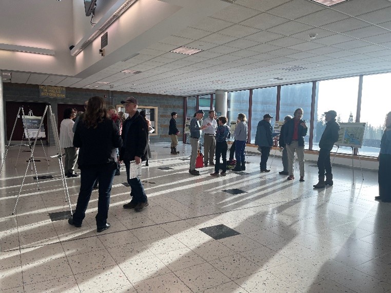
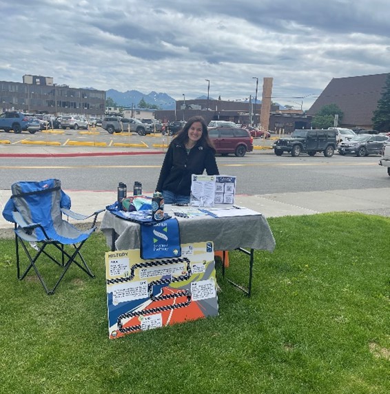
We had a scoping period earlier in 2023 to hear what you all had to say and start forming the purpose and need statement. This included an open house, the launch of our website and online materials, a public comment period, and lots of data and information collected by our environmental and engineering teams.
2. Concepts
We developed multiple concepts and released two in the December 2023 public meeting: a 3-Lane Passing Concept and a 4-Lane Barrier or Median Divided Concept. How’d we get here? We took all the information and data collected, and we sketched some ideas. We shared those ideas with our involved stakeholder working group that represents many local and federal agencies and community organizations and asked the group to help refine the ideas; then we shared the results with the public in the December 2023 public meetings in Anchorage, Indian, and Girdwood. Missed the meetings? No problem! You can check out the meeting materials in our online open house archive link.
3. Draft EA - We Are Here
DRAFT EA – We are here! Now that we have a proposed action of what the improvements look like, what size they are, and where they will be located, we are conducting environmental analysis to determine what the environmental impacts might be. We have written an environmental assessment (EA) to record all the information gathered and required environmental analysis. The EA took us quite a while to write, because we were working with a plethora of local and national agencies and so many stakeholders. It was released in December! You can take a look at the Draft EA . We held another round of public hearings in Anchorage, Girdwood, and Indian to share what’s in the document and ask for your opinions with an accompanied comment period between December 29, 2025 through February 27, 2026. The comment period is currently closed and feedback is being incorporated into the Final EA.
FINAL EA – The final step in NEPA is a Final EA document and decision. After we hear from the public and the agencies and make any final changes, we will publish a Final EA document. It will include all the comments received during the comment period and responses to those comments. Because of the size of this project, the team will also develop a funding and phasing plan.
4. Final EA
The final step in NEPA is a Final EA document and decision. After we hear from the public and the agencies and make any final changes, we will publish a Final EA document. Because of the size of this project, the team will also develop a funding and phasing plan.
This may seem like a lot to go through before we finally get to design and start digging dirt, but it’s an important process that involves considering a lot of information to make sure we are doing the best we can and thinking about all the parts and pieces beforehand.
5. Design & Construction
Once NEPA is complete, there is still a lot of work to do. Construction will be broken up into stages to align improvements with available funding and local contractor resources while minimizing impact on the traveling public. We anticipate that the first phase would be in the range of MP 109 to MP 107 - Rainbow curves. This location was identified as a good first stage option based on where we see crash clusters. This area had the greatest number of all crash types and specifically head on crashes. This area also has the second highest location for run off the road crashes within the proposed project limits. The proposed action in this stage would include construction of a minimum of one mile of 4-lanes including flattening the s-curves at Rainbow, railroad realignment, pathway, improvements to the Rainbow trailhead parking area, and a pedestrian undercrossing.


What are we doing now?
Let’s talk action. As in construction not just this design talk. In the meantime, we will be advancing smaller construction projects starting in 2025 so that we can continue to improve safety in the corridor while the larger projects are being designed and built. We’re calling these smaller efforts “Safety Express Projects.” We have three Safety Express Projects:
Project 1:
Enhanced Signage for Safer Driving (completed June 2025!)
The first project focused on increased visibility and improved wayfinding through new signage. Key upgrades included:
- Trailhead distance markers at 1,500 feet and 1,000 feet
- Larger recreational & cultural signage (parking, biking, camping, scenic views, and trails)
- New milepost markers (also within pullouts)
- Repaired speed radar signs
- McHugh Creek hidden driveway notice
- Falling rocks warnings
- No passing zones
- Vehicle delay requirements
- Curve warnings
- Pullout notifications
- Speed reduction zones
Project 2:
McHugh Creek Left Turn Lane (Construction in 2026)
The second safety express project uses state funding to construct a left turn lane at McHugh Creek Recreation Area. The contract was awarded to Granite in Nov 2025. The design includes:
- State funded
- Constructed within the ROW
- No impacted protected resources
- Design Completed
- Bid in Oct 2025
- Awarded to Granite
- Final paving anticipated by June 2026
Project 3:
MP 113.2 Ice Fall Slope Stabilization (in the future!)
The third safety express project will use Highway Safety Improvements Program (HSIP) funds to enhance safety near MP 113.2 by installing rock catchment systems, stabilizing slopes, and improving drainage. Design is anticipated for 2026.

9. Concepts
So… you want to know what we looked at before we proposed the 4-lane divided highway? We looked at bunch of ideas with our stakeholder working group – from tunnels, to separated pathways, to changing the purpose and need to reflect mobility rather than congestion – we had so many concepts that in December 2023, we narrowed it down to two ideas. The two concepts we considered in preliminary engineering are (1) a 55 mph, 3-Lane Alternating Passing concept and (2) a 55 mph, 4-Lane Barrier, Median, or Vertically Divided concept. We did that after talking with dozens of stakeholders and the public. This is a tricky process because we are balancing many different types of roadway users – whether it’s recreational, commercial, commuters, tourists, or residents, we designed these concepts to meet current safety and roadway standards as well as the needs of both people traveling through the corridor and those traveling to locations along the corridor.

Where can you learn more? Take a look at our archived online open house in our public involvement library here.
Note: remember these are simply IDEAS with only 15engineering done. That’s just enough engineering to identify impacts and a footprint for analysis in the EA. These are concepts of what could happen and are in no way final. There is a lot more work to be done, but this visual gives you a good graphic instead of confusing engineering words. Are you as jazzed about improving safety along this section of the Seward Highway as we are?!
10. Give Feedback
Now, we have a big favor to ask of you. We need to hear from you. This is a community project that impacts a lot of people. The commuters, the recreators, the drivers, the residents, the visitors: we need you! How do you use the highway? What are some things we should consider? What would you like to see? What features do you use? Do you drive through or stop along the way?

Your voice matters – we promise!
We read ALL the comments and consider them in the design. All comments will be documented in our final EA document.
We want to hear all of it. Contact the team!
Join our mailing list for updates as we move forward and the latest news on ways to give us feedback.
TransportationX
The TransportationX program involves new ways of working that are outcome focused, versus process focused, and emphasize community teaming, agile project management processes, and new ways of resourcing to achieve success. These efforts contribute to our vision of organizational excellence, and investment areas of Safety, State of Good Repair, Economic Vitality, Resiliency, and Sustainable Transportation. The Safer Seward Highway Project has been designated as an Alaska DOT&PF TransportationX project.
For more information, check out DOT&PF’s TrX Program (arcgis.com) page.

-
Project Fact Sheet
-
FAQs
Public Meeting Links
-
Past Online Meeting
-
Interactive Map Tool